
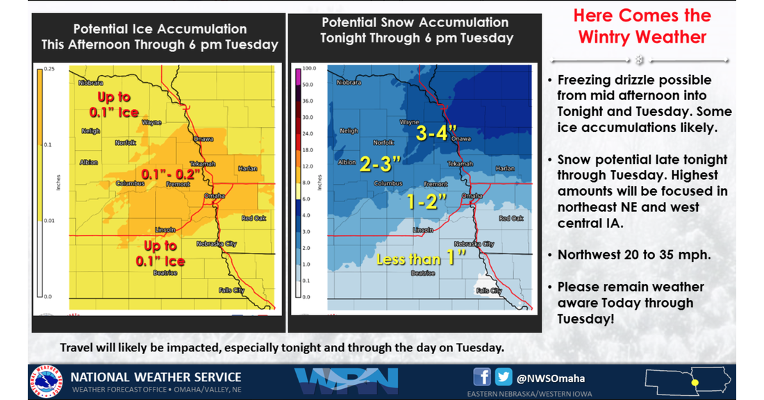
 Are you ready for another storm? The National Weather Service is reporting 2-3 inches of snow will fall tonight after freezing drizzle leaves dangerous conditions first.
A Winter Weather Advisory begins at 6 p.m. tonight and will last through 6 p.m. Tuesday. Winds will gust as high as 40 mph on Tuesday. Temperatures will be in the teens. Travel difficulties are expected due to this storm. 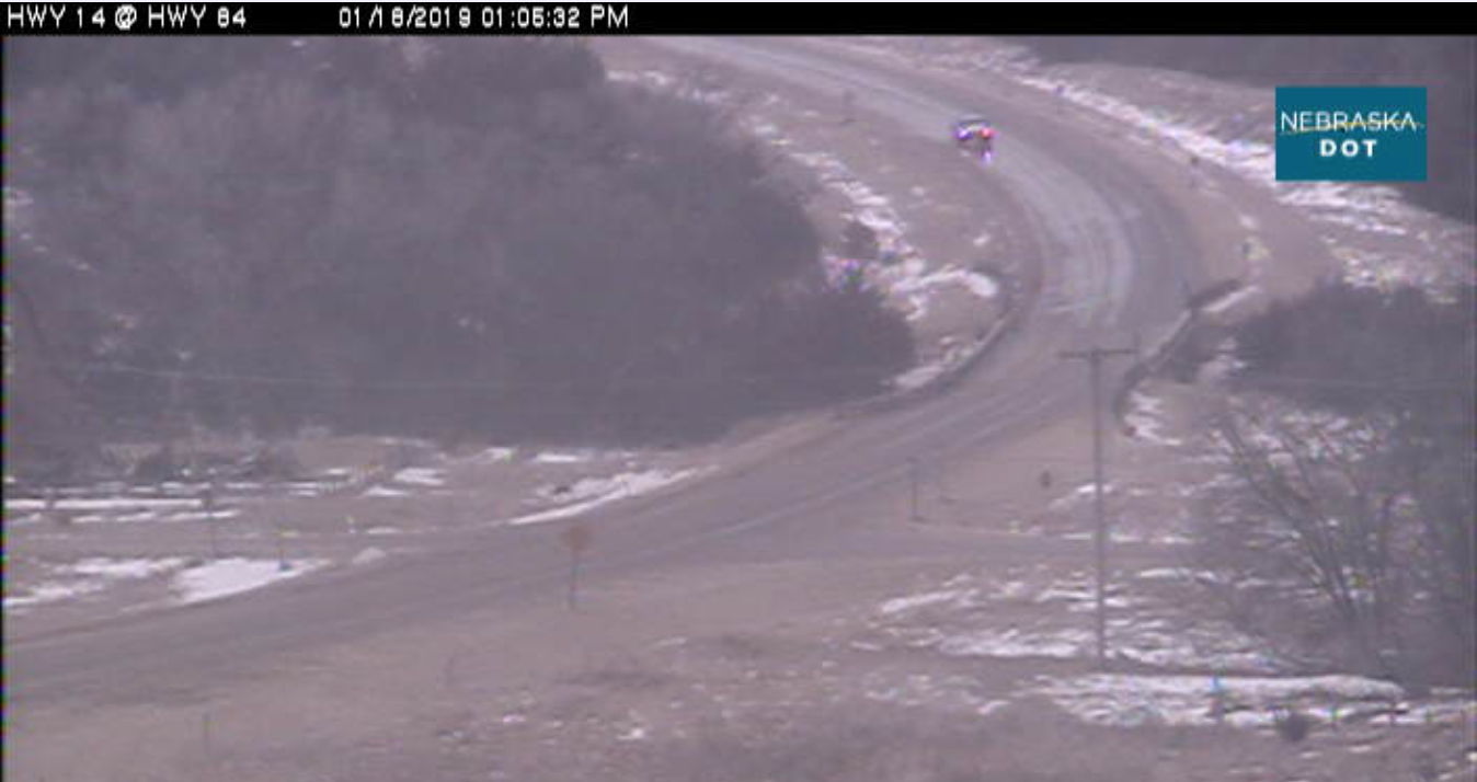 If you're traveling through Knox County on Friday, the sheriff's office is recommending reduce speed and use caution. According to the Nebraska Department of Transportation, all highways through the county are completely ice covered.
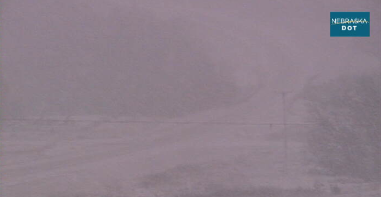
The sheriff's office is also reminding motorists to clear their windshield of ice and snow before traveling. Failure to do so is no only dangerous but illegal. Knox County is in a Winter Weather Advisory through 6 a.m. Saturday. Snow accumulations are expected to total 1-3 inches. Locally higher amounts of snow are possible, according to the National Weather Service. 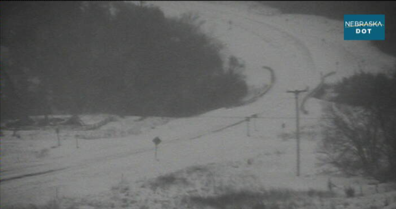 Motorists are advised to stay off highways since all roadways in Antelope and Knox counties remain completely snow covered.
According to the Nebraska Department of Transportation, Highway 275 is completely snow covered from Newport east to the Battle Creek spur. Highway 14 is also completely snow covered from Niobrara south to Petersburg. Highway 12 from near Mills eat to Ponca is completely covered, as is Highways 121, 59 and 84. Winds will gust up to 40 mph throughout much of Friday. Wind will drop to 15 mph with gusts of 20 mph around 5 p.m. with the wind chill remaining around -9 all day. Saturday will be sunny with temperatures topping at 27. 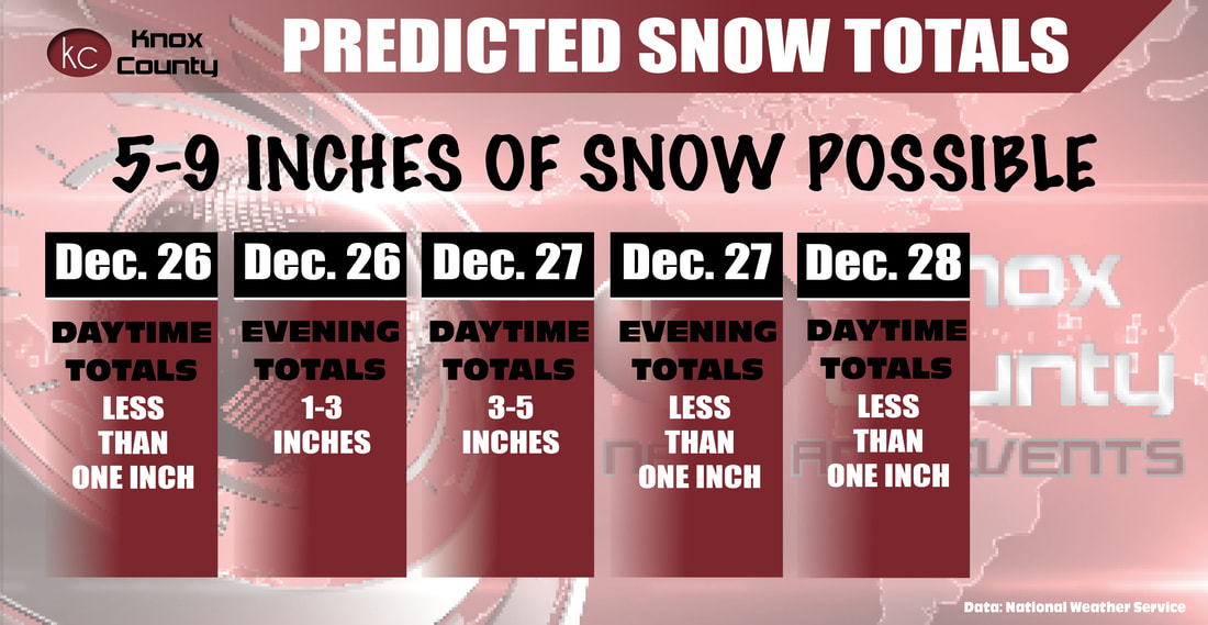 A Winter Storm Warning will be in effect as of 6 a.m. Thursday morning through 6 a.m. Friday with 5-9 inches of heavy snow expected throughout the area and winds gusting up to 35 mph.
Holt County is expecting 5-13 inches of snow, meaning the line for heavy snowfall likely will run through Holt. Should it move more to the east than expected, snowfall in Knox and Antelope counties will be higher than currently predicted. Madison County is predicted to receive 1-4 inches of snow. Traveling in Knox and Antelope counties may be difficult with areas of blowing snow reducing visibility for commuters. The high Thursday will be 32 degrees in the morning with temperatures falling throughout the day to a low of 13.  Bloomfield will have a 10 a.m. late start on Monday, Dec. 3, due to the weather.
 The Kox County Sheriff's Department is recommending no travel during the Winter Storm Warning, which will last until Sunday evening.
The severity of the winter storm moving through Nebraska has increased, according to the National Weather Service. Winds will gust between 45-55 mph with more than 12 inches of snow expected in Knox County and up to 18 inches in Holt County and west. A winter storm warning is in effect until 6 p.m. Sunday. 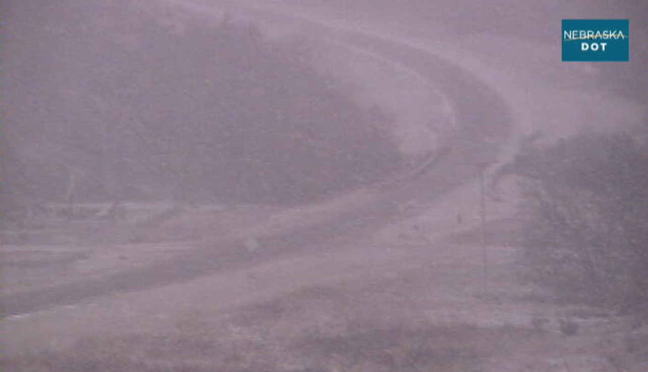 The severity of the winter storm moving through Nebraska has increased, according to the National Weather Service.
Winds will gust between 45-55 mph with more than 12 inches of snow expected in Knox County and up to 18 inches in Holt County and west. A winter storm warning is in effect until 6 p.m. Sunday. 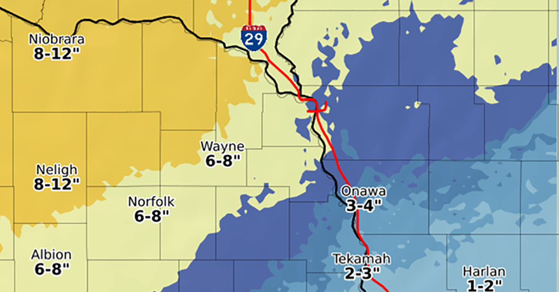 Up to 12 inches of snow is possible over the weekend in Knox County, and a Winter Storm Watch has been issued from Friday evening through Saturday night.
According to the National Weather Service, heavy mixed precipitation will begin Friday night, making travel very difficult. Hazardous conditions could impact the evening commute on Friday. The NWS is calling the weekend storm a "significant winter storm event" with a potential for significant snow, sleet or ice accumulations. 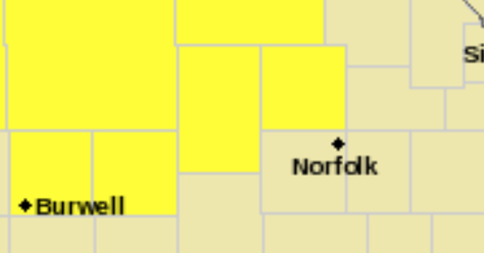 A Tornado Watch has been issued for Knox County through 11:00 p.m. on Wednesday, July 18.
At 3:40 p.m., the National Weather Service issued a Tornado Watch for multiple Nebraska counties, including Antelope, Garfield, Knox, Wheeler, Boyd, Holt, Pierce, Brown, Keya Paha and Rock counties. 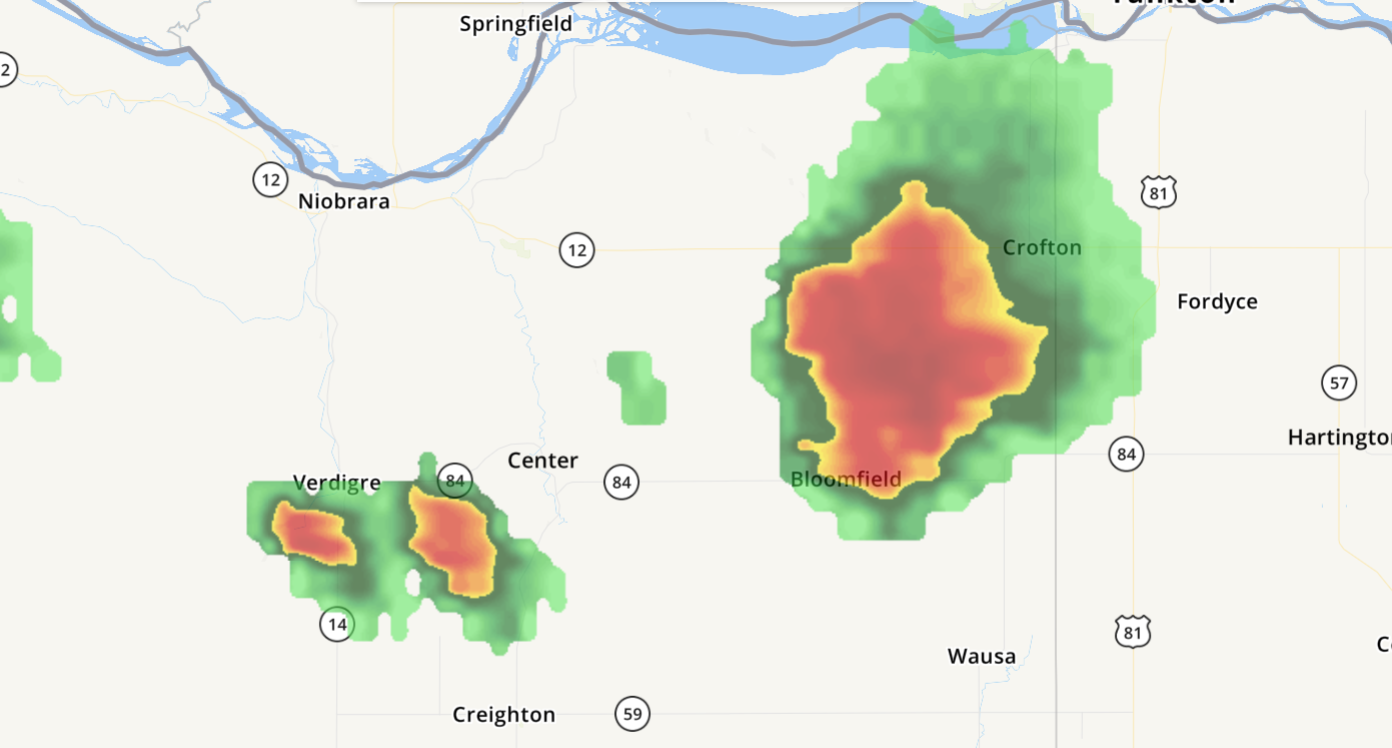 The National Weather Service has issued a Severe Thunderstorm Warning for the Bloomfield and Wausa areas.
At 3:55 p.m. a storm was located near Bloomfield moving southeast at 20 mph. Quarter-sized hail and 60 mph wind was expected with possible damage to vehicles, roofs, siding and trees. Locations impacted include Bloomfield, Wausa and Magnet. |
 RSS Feed